Ghost Freeways
The Embarcadero Freeway and the Central Freeway: where they ran, what they looked like, and how we know.
Explore them in 3Dfull screen, over today's city
Two freeways in the air
CHPW 1954–65 · PP 1552-BIn the late 1950s the state built two double-deck concrete viaducts into San Francisco. Both had southbound traffic on top and northbound below. Both were meant to go further, and both were stopped short by the city's freeway revolt. One earthquake on 17 October 1989 closed them both. Neither came back.
The Embarcadero Freeway (I-480) carried Bay Bridge and Bayshore traffic along the waterfront, past the Ferry Building, to a dead end at Broadway. It was built in three contracts from May 1955 and finished to Broadway in early 1959. It was California's first double-deck freeway, alongside Oakland's Cypress Street Viaduct. Demolition began on 27 February 1991.
The Central Freeway (US-101) left the James Lick Freeway on a 1955 steel viaduct, became a concrete double deck near Market Street, ran up the east side of Octavia Street, and ended at Turk and Gough, a block west of Civic Center. It came down in three stages: north of Fell in 1992, the upper deck in 1996, and the rest in 2003. Octavia Boulevard opened on its land in 2005.
This page collects the project's research into one place. It is built from period engineering drawings, the state highway magazine, old topographic maps, parcel lines and lidar, and it is checked against ten period photographs. Every figure below is drawn from the project's route and structure data.
Explore it in 3D
INTERACTIVE MODEL · TODAY'S CITYBoth freeways are rebuilt from the same route and structure data as the drawings below, standing over a model of today's city: USGS terrain, today's street map and see-through OpenStreetMap buildings. Drag to move, pinch or scroll to zoom, and twist or right-drag to turn. Switch between 1959, new and pale, and 1989, weathered, as the earthquake found them. Every map and photo comparison on this page has a See in 3D button that takes the model to the same spot.

Timeline
1954 → 2013- ECHPW describes the planned route: "an eight-lane divided highway, the division is in a vertical plane rather than a horizontal".CHPW Mar–Apr 1954, pp. 14–15
- CCentral first unit opens: an elevated six-lane steel viaduct from the James Lick (Bayshore) Freeway to Mission St / South Van Ness. It is still standing.CHPW Mar–Apr 1959 p. 10; Wikipedia
- EEmbarcadero construction begins (Unit 1: MacDonald, Young & Nelson / Morrison-Knudsen).CHPW May–Jun 1957
- EEmbarcadero first unit opens, from the Skyway to Mission St with ramps at Main and Beale. The ribbon is cut at Beale and Mission.CHPW May–Jun 1957, pp. 45, 63
- CPeter Kiewit Sons start the Central second unit, a two-level concrete viaduct over Market St to Turk St.CHPW May–Jun 1959, pp. 40–41
- SFBoard of Supervisors Res. 45-59 drops most of the planned SF freeways: the freeway revolt.Wikipedia; preservenet
- EEmbarcadero extension to Broadway finished in March 1959. Wikipedia gives the opening as 5 Feb 1959.CHPW Mar–Apr 1960; Wikipedia
- CCentral second unit completed: South Van Ness to Turk St, 1.4 mi, $7,803,948.CHPW May–Jun 1959
- ETraffic is light, so part of the Embarcadero upper deck becomes a fenced sightseeing "vista area" with 60 parking spaces, reached from the Broadway on-ramp.CHPW Mar–Apr 1961
- EClay and Washington St ramps built by Stolte Inc. for $1.42M to serve the Golden Gateway redevelopment.CHPW May–Jun 1964, May–Jun 1965
- E+CCable restrainers added: 1974 on the Central (hinges), 1985 on the Embarcadero (pinned column-to-cap joints). Neither freeway got column jackets.PP 1552-B
- EVoters reject removing the Embarcadero Freeway.project research notes
- E+CLoma Prieta. Embarcadero lower columns and caps crack from Bent 75 to Bent 88, and Bents 75–83 are shored with timber. On the Central, columns crack at Bents 42–49, north of Oak/Fell, and the northern part closes.USGS PP 1552-B
- EEmbarcadero demolition begins. The Terminal Separation south of Bent 56 is kept as I-80 ramps.Wikipedia; cahighways.org
- CCentral north of Fell, with the Franklin and Gough ramps, is demolished. The Board bans new freeways north of Market.Wikipedia; Hoodline; SFCTA SAR 04-1
- CMission–Fell closes. The upper deck and the Oak St on-ramp are removed by 15 Nov 1996.FoundSF; PP 1552-B; SFCTA
- CThe lower deck reopens northbound-only to the Fell St off-ramp. Then three ballots: Prop H (1997), Prop E (1998) and Prop I (1999) settle on a boulevard.FoundSF; Hoodline; SFCTA; FHWA
- CMission St–Fell St structure demolished.SFCTA SAR 04-1
- EThe I-80 Fremont/Folsom exit, the last surviving piece of the Embarcadero system, goes with the Bay Bridge West Approach rebuild.AARoads
- COctavia Boulevard opens, with a new touchdown ramp from Mission to Market on the old right-of-way.Wikipedia; Streetsblog 2011
- CThe former ramp block at Oak/Fell/Laguna/Octavia (Parcels O and P) becomes Hayes Valley Farm.Wikipedia
Embarcadero Freeway
I-480 · BR. 34-55 · BENTS 56–121Coming off the Bay Bridge approach at Rincon Hill, the freeway crossed Folsom, ran northeast parallel to it past the old Transbay Terminal, and then curved north onto The Embarcadero between Folsom and Howard. From there it ran straight up the waterfront, across the foot of Market, past the Ferry Building and on to Broadway. At Broadway a double-deck ramp turned west toward Battery and Sansome, and a short stub pointed north toward a Golden Gate extension that was never built.
To place it today: north of Mission St, the Muni E/F streetcar tracks in The Embarcadero median run under the old deck, within about 8 m of its centerline. If you stand on the F-line platform opposite the Ferry Building, you are under where the double deck was.
Landmarks along the line
- S1 · Rincon Hill / I-80 junctionThe I-80 and Bay Bridge connectors merged near Harrison, west of Essex. The parallel structures merge into one map symbol here, so the position is only good to ±10–15 m. medium confidence
- J2 · Bent 56, Main & BealeThis is where the first unit opened on 8 Apr 1957. A NB exit dropped to Main at Mission and a SB entrance rose from Beale. medium
- South stub (SE line)A second box ran from the Market junction to just south of Howard. It was built for a planned Southern Embarcadero / I-280 link and never carried traffic. medium
- M · Market StThe twin boxes became one wide deck here and crossed the foot of Market. high
See in 3D - Ferry Building, about Bent 87Centerline about 40 m from the building's west face (39.8 m on the as-built plan, PP 1552-B Fig. 103), deck edge about 31 m. Steel H-piles up to 225 ft long were driven toward bedrock about 250 ft below. high
See in 3D - J3 · Washington / Clay rampsAdded in 1965. The 1973 topo lands them between Davis and Drumm, beside today's Embarcadero Center. CHPW and cahighways say Front St instead. medium
See in 3D - JB · Bent 106, BroadwayThe mainline ended in a dead-end stub pointing north. The double-deck ramp ran along the north side of Broadway: the lower deck landed at Abut B117 just east of Battery, the upper deck started at Abut B121 just east of Sansome. high
See in 3D
Profile roadway & ground, south → north
Why so tall? The lower deck sat about 11 m above the street, higher than on the sister Cypress Viaduct in Oakland, because the State Belt Railroad ran beneath it. With a 7.5 m deck-to-deck spacing, the upper roadway was about 18.5 m up and its railing about 20 m (66 ft). That fits the popular "70 feet high" figure.
Central Freeway
US-101 · BR. 34-077 · 13,994 FTThe Central left US-101 at the 13th St / Division interchange on the 1955 steel viaduct, which still stands. West of South Van Ness it became a single-level concrete viaduct, stacked into two decks just before Market and crossed Market on one long prestressed span. North of Market it ran over the lots on the east side of old Octavia Street. At Laguna a NB exit dropped to Fell and a SB entrance rose from Oak. Just north of Fell it swung NNE on a diagonal across Hayes, Grove, Fulton and McAllister. Near Golden Gate it split: the upper deck went down to a SB on-ramp at Turk and Gough, and the lower deck went down to a NB off-ramp at Franklin and Golden Gate.
To place it today: the double deck's 110-ft right-of-way was the strip just east of old Octavia St. That strip is now the east half of Octavia Boulevard and the "Central Freeway parcels", such as Parcel T at 188 Octavia. North of Fell, diagonal lot lines in today's parcel map still trace its path.

Landmarks along the line
- Mission St junctionToday's freeway ends here. East of it, the 1955 steel plate-girder section still carries US-101 traffic. West of it, the 1959 concrete viaduct came down in 2003, and a 2005 touchdown ramp now uses the same right-of-way. high
- Span 21 over Market StOne long prestressed span with heavy bents on the sidewalks. The model treats it as a 45.5 m clear span. Where the single deck became a stack, south of Market, is the least certain part of the alignment. medium / low
See in 3D - Octavia parcelsToday's Octavia Blvd right-of-way is 133 ft wide. Old Octavia St was 68.75 ft. The freeway strip was the 110 ft east of it, centered about 19 m east of today's boulevard axis. medium
- Fell & Oak ramps at LagunaThe NB exit left from the lower deck's left side and landed at Fell & Laguna. The SB entrance rose from Oak & Laguna. CHPW 1959: "One block of Laguna Street between Oak and Fell Streets has been made one-way". medium
- North of Fell → Turk / GoughThe decks stayed stacked to a split just south of Golden Gate Ave. The 1973 topo, the parcels and photo wnp28.2776 all agree on this. Both terminus ramps were graded down to the street at no more than 2%. medium; terminus ramps low
See in 3D
Profile roadway & ground, US-101 → Turk St
Which way on top? This project first assumed the Central's upper deck carried northbound traffic. The primary source says otherwise: "Southbound traffic uses the top level while northbound traffic travels on the lower level" (CHPW May–June 1959, p. 41). Later events agree. When the upper deck came off in 1996, the remaining deck carried only northbound traffic, and the SB Oak St on-ramp went with the upper deck.
Architecture
AS-BUILT BENTS · PP 1552-B FIGS. 107–113, 137–141Both freeways used the same structural system, described by the district construction engineer in 1957: "a continuous reinforced concrete box girder viaduct, of repeating 80-foot span, supported by reinforced concrete bents on steel piles." Each bent is a two-storey portal frame. The lower cap is reinforced concrete with fixed column joints. The upper cap is post-tensioned and pinned onto its columns. The columns are plain rectangular prisms in board-formed concrete, with no capitals or flares. From below, the soffit reads as a flat, smooth slab bounded by the cap beams.
Deck furniture
Rail. A low concrete parapet about 0.5 m high carried short flared concrete posts at about 2.1 m spacing, topped by a single metal tube at about 0.88 m. This is the 1950s Division of Highways bridge rail. Its outer face was flush with the box fascia, so each deck read as one continuous grey band roughly 2 m tall. That band is the dominant line in every street-level photo.
Light standards. 1959 photos at the Main St ramp show tapered steel poles 9–10.5 m tall, with an upswept davit arm and a teardrop mercury-vapour luminaire. But the photo check found no deck-top poles in 7 of 10 views, on the Central and on the Embarcadero north of Market. Poles appear only south of Market. How the lower deck was lit is undocumented.
Signs. Overhead signs hung on steel lattice truss bridges. The Central drawings show an anchor pedestal "for future sign bridge" on the Bent 48 cap. Panels were green porcelain enamel with white reflective button copy in Highway Gothic. White-on-green guide signs were approved nationally in January 1958, in time for the 1959 openings.
Pavement. In 1959 the decks were pale bare concrete with painted white skip lines and no edge lines. By 1989 the lane lines were rows of small raised white markers (Botts' dots) instead of paint, with a solid white right edge line, on a darker asphalt surface.
Finishes sampled from colour slides, 1959–1991
#C9C6BE#9A978F#5E5B55#8E8C86#B8B5AD#3E3E3C#A7A9A6#1F5A3A#3F5A2EThe swatches show the data's literal colours and do not change with the page theme. By the 1980s many Embarcadero columns were covered in ivy (PP 1552-B Table 16: "obscured by ivy"), and bent numbers were painted on column faces (a 1991 photo shows "95").
Then & now
10 VIEWPOINTS · POSED FROM PERIOD PHOTOSFor each of ten period photographs, camera position, heading and field of view were solved from landmarks at known bearings: the Ferry Building tower, Coit Tower, the Transamerica Pyramid and the City Hall dome. The 3D model then rendered the same view. The photos belong to their archives, so they are linked, not reproduced: open each one next to our render. Heights were checked as ratios at a bent, using the 7.5–7.6 m deck-to-deck spacing as the scale. They agree within about 1 m at four sites. The renders come from the current model, the same one as in the explorer above: See in 3D puts you at the photographer's position to look around.
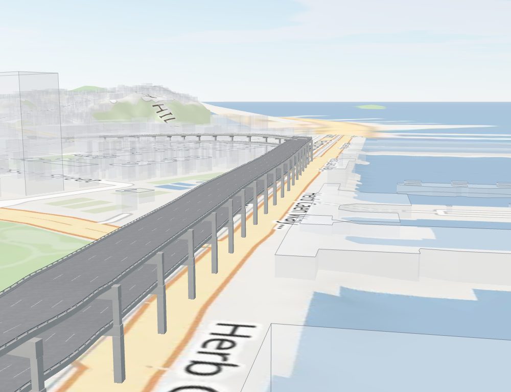
From the Ferry Building tower, NW up The Embarcadero
Under construction. The far end and the Broadway curve fall within about ±5 m. The bent rhythm matches. Near Washington St the 1958 deck looks wider than modelled, which is unresolved.
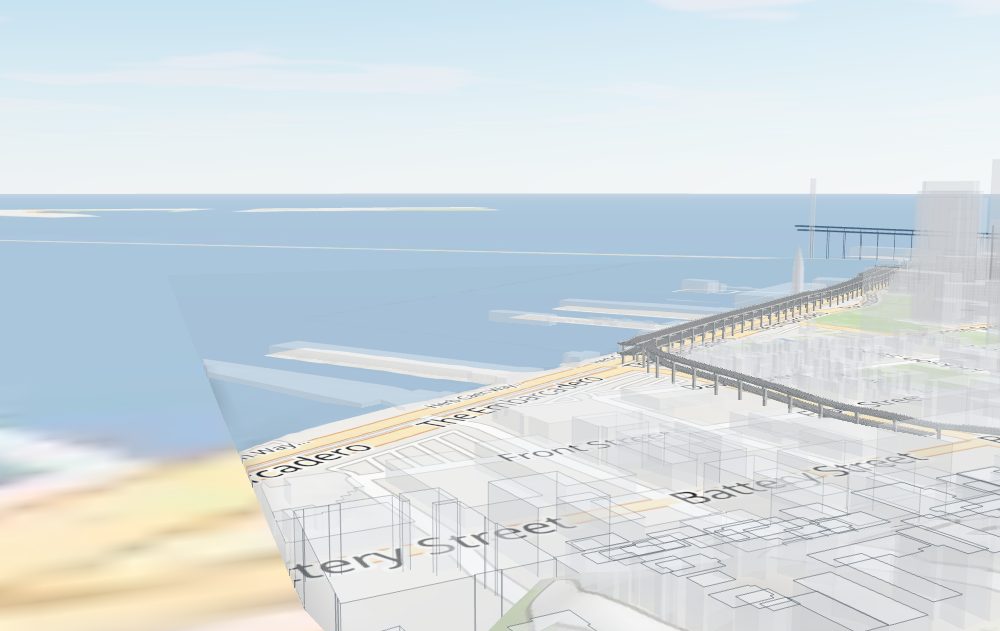
From Telegraph Hill, SE to the Bay Bridge
The Broadway curve and the run down the waterfront land within 1–2% of the frame. The new concrete reads bright, almost white, as in the photo.
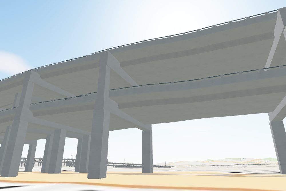
Under the double deck at the foot of Market
Same structural vocabulary: continuous columns outside the deck edges, flat board-formed soffit, fascia band with tube rail, and one tall pole on the upper deck.
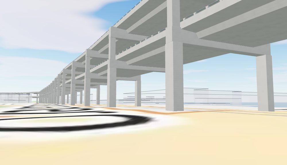
The Embarcadero at Clay, north along the deck
Height check: the photo gives about 10.2 / 17.7 m against the model's 11.0 / 18.5 m. The photo shows no light poles along about 300 m of upper deck. The photo predates the Clay and Washington ramps, which opened in 1965.
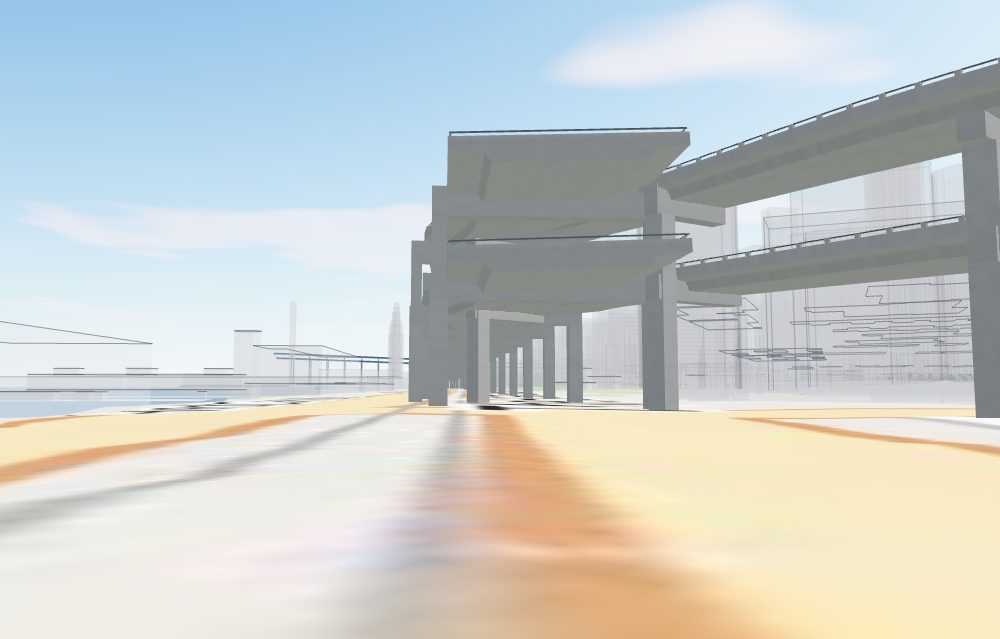
Broadway: the freeway's end and the off-ramp
The guessed 36 m stub length is right to within about one span. The stub ends are clean and square, and the ramp stands on tall single columns at its outside edge.
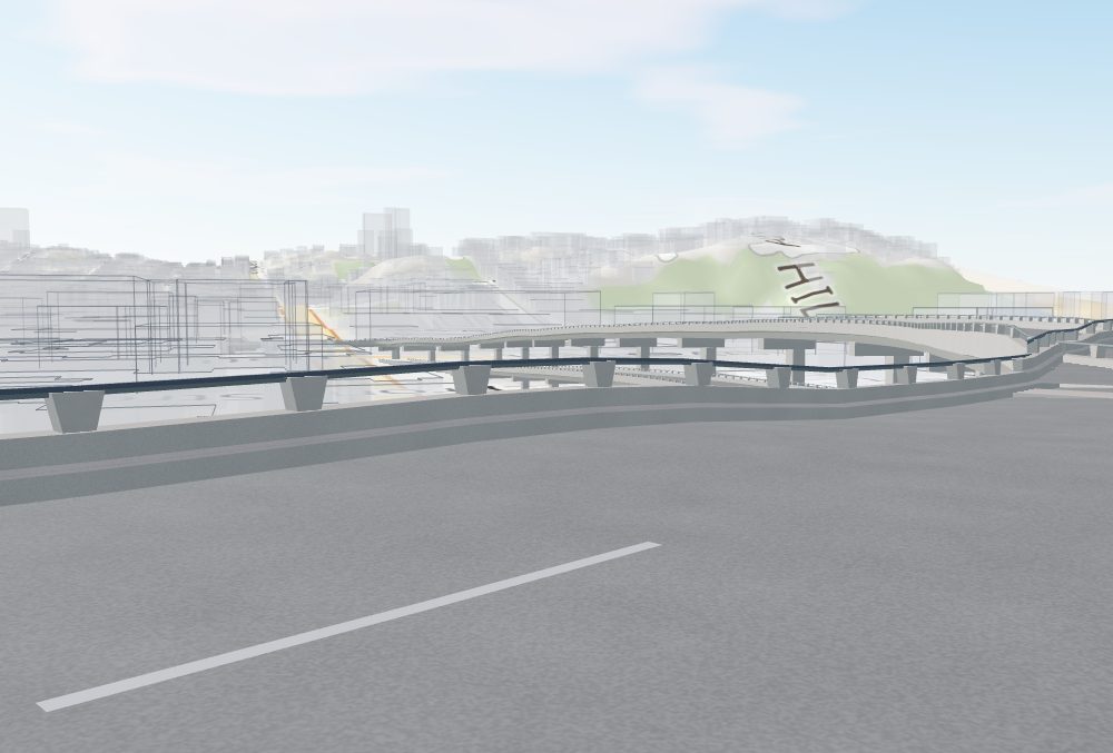
From the upper deck at Broadway, W toward Telegraph Hill
Not reproduced. The photo shows a double-deck arc sweeping through about 90° only 100–150 m away. No pose tried reproduces it. This is still an open question.
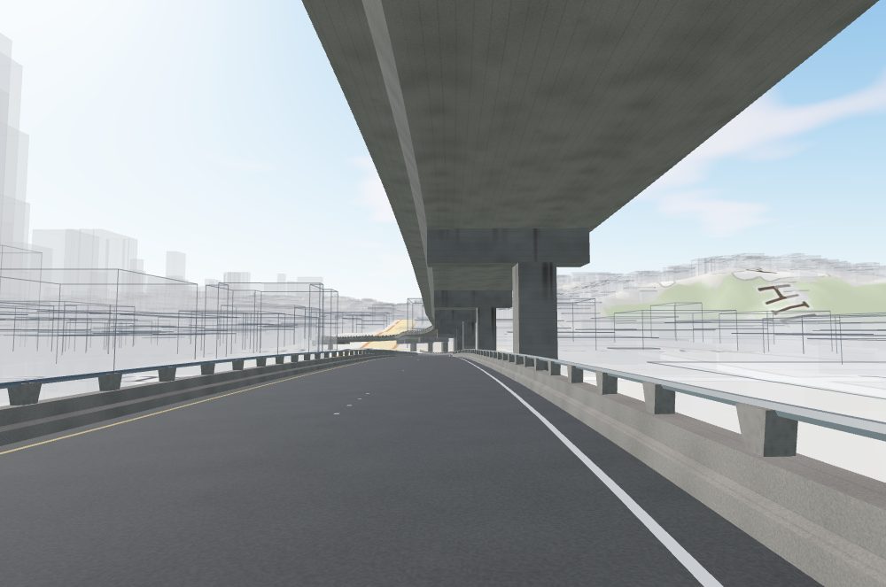
On the Broadway ramp after the quake, W to the Pyramid
Raised lane markers and a descending lower deck. The upper deck is offset north on one-sided columns, leaving the south half open to the sky. This photo is the source of the stagger in Fig. 7.
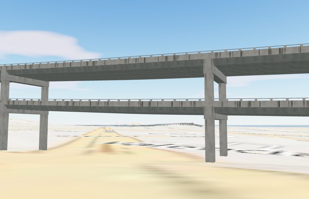
Market near Octavia, east to the crossing
Both decks cross where the model has them. The photo shows one long clear span over Market (Span 21) with massive bents on the sidewalks, and the model now matches it.
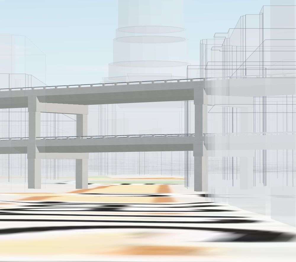
Fulton near Gough, east to the deck and City Hall
A telephoto view, about 12° vertical field of view. The photo gives about 7.2 / 14.8 m above Fulton against the model's 6.9 / 14.4 m, which confirms the grading down north of Grove.
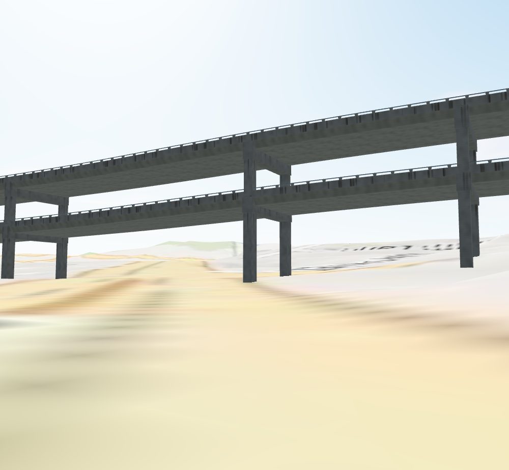
Market near Valencia, SW under the crossing
The deck rails land within about 1 m at 75 m. The crossing angle and the Market St vanishing point match. The photo has fewer, slimmer supports than the render.
How we know
SOURCES · METHODS · CONFIDENCENo single source gives the whole picture. The alignment comes from a 1973 topographic map registered to today's streets. The structure comes from as-built drawings reproduced in a 1998 earthquake report. The words, dates and deck directions come from the state highway magazine. Parcels, lidar and photographs check all three.
| Source | What it gave us | Confidence |
|---|---|---|
| USGS Professional Paper 1552-B (Yashinsky 1998), Loma Prieta: Highway Systems | Caltrans as-built plans, elevations and bent sections for the Embarcadero Viaduct (Br 34-55, Bents 56–121) and the Central Viaduct (Br 34-077). Bent elevations give deck-to-deck spacing of 7.50 / 7.62 m, box depth, cap and column sizes, Span 21, the Broadway B-line abutments, retrofit history and damage tables. | high |
| California Highways and Public Works (CHPW), 1954–65 | Route descriptions, contracts, costs, opening dates, lanes, 52-ft roadway, the upper SB / lower NB assignment on both freeways, ramp lists, H-piles up to 225 ft. | high |
| USGS 1:24,000 SF North quad, 1956, photorevised 1968 & 1973 | The primary horizontal trace. The purple freeway symbol was colour-masked and snapped to centerlines, after a local, block-by-block registration to OSM streets: the sheet draws streets about 9–13 m east/south-east of true along the Embarcadero (corrected block by block; Pier 1–5 bulkheads then agree within 1 m) and 8 m E / 11 m S on the Central. | ±5 m waterfront ±5–10 m Rincon Hill |
| DataSF parcels (active & retired) | The Central's 110-ft right-of-way east of old Octavia St, and the diagonal lot lines north of Fell that confirm the stacked decks and the ~4 m westward correction. | medium |
| USGS 3DEP lidar (CA_SanFrancisco_1_B23) | Ground elevations along both routes, plus the deck heights of surviving structures: the 1955 Central steel section and the I-80 decks where the Embarcadero tied in at Rincon Hill. | high |
| OpenStreetMap | Present-day control: the street centerlines in these maps, the Muni E/F tracks (within about 8 m of the old centerline), the Ferry Building footprint, and today's touchdown ramp on the Central's old right-of-way. | high |
| Period photos: OpenSFHistory, SF Memory, SFSU DIVA | Look and finish: rails, poles, signs, concrete tone, ivy. Ten posed comparisons cover heights, bent placement, the Broadway stagger and the Fulton check. | medium per pose |
| NISTIR 4857 & Cypress load-test report | Sister-structure details not dimensioned in the SF drawings: slab and web thickness, overhang, column depth. Also used only as a sanity check on photo heights. | borrowed |
| Secondary: Wikipedia, cahighways.org, AARoads, FoundSF, Hoodline, SFCTA SAR 04-1, FHWA | Exit lists, dates of the removal politics, "70 feet high and 52 feet wide", and the 1996–2005 Central sequence. | cross-checked |
Open questions
WANTED: FULL CALTRANS AS-BUILT SETS- The Rincon Hill interchange. PP 1552-B Fig. 101 shows two parallel double-deck lines, "E" and "FO", plus a ramp "BFO" starting at grade. These could not be decoded. Where the model's stacked connector crosses today's I-80 deck near 2nd St, the lower roadway would sit 1.65 m below the I-80 surface, so the alignment or the masking there is wrong.
- The 1964 Broadway arc. Photo sfm008-00275 shows a double-deck arc no modelled structure explains. Either the photo's position or date is different, or the B-line curved much more tightly than the 1973 topo shows.
- Washington/Clay touchdowns. The 1973 topo lands them between Davis and Drumm. CHPW and cahighways describe a connection to Front St.
- Main vs Beale direction. The exit list and today's one-way streets give Main as NB off and Beale as SB on. A 1959 slide caption speaks of "the Main Street on ramp toward the Bay Bridge", which may be a caption error or the 1957–59 layout.
- Where the Central stacked. Between South Van Ness and Market, and whether the lower deck was offset anywhere, especially over Market. The Br 34-077 sheets for Bents 1–28 would answer it.
- Three lanes or two? CHPW Mar–Apr 1959 mentions "three upper-level lanes" SB, while CHPW May–Jun 1959 says two lanes each way over most of the section.
- Lighting. Light-pole spacing and how the lower decks were lit are undocumented. The 1958 Washington St deck also looks wider in the photo than modelled.
- Terminus ramps at Franklin/Golden Gate and Turk/Gough: their exact geometry, and which way the one-block Laguna St ran between Oak and Fell.
Credits
DATA · PHOTOGRAPHS · LICENCESPeriod photographs
The ten comparison photographs belong to OpenSFHistory / Western Neighborhoods Project (wnp numbers) and SF Memory (sfm numbers). They are linked from each comparison, not reproduced here. Please see the archives for terms of use.
Caltrans and USGS sources
Structural dimensions come from Caltrans as-built plans for Bridges 34-55 and 34-077, as reproduced in USGS Professional Paper 1552-B (Yashinsky 1998). Route history, dates and quotations come from California Highways and Public Works, the magazine of the California Division of Highways (now Caltrans), 1954–65.
The alignment is traced from the USGS 1:24,000 San Francisco North quadrangle (1956, photorevised 1968 and 1973).
Maps and the 3D model
Street centerlines, buildings and today's freeways: © OpenStreetMap contributors, under the Open Database Licence (ODbL 1.0). The derived data in the model stays under the ODbL.
Street-map imagery in the model: rendered from OpenFreeMap vector tiles, © OpenMapTiles, with a style adapted from OpenFreeMap Liberty.
Terrain and ground heights: USGS 3D Elevation Program (3DEP) bare-earth elevation and lidar (CA_SanFrancisco_1_B23), public domain.
Parcel lines: City and County of San Francisco, DataSF.
This page
Maps, profiles and sections are drawn from the project's route and structure data. Renders and the explorer are the project's own 3D model, built with three.js. Type: Overpass and Public Sans (SIL Open Font License), via Google Fonts.
Secondary sources (Wikipedia, cahighways.org, AARoads, FoundSF, Hoodline, SFCTA, FHWA) are cited where they are used.